Trigger warning: This post contains heartfelt love for publically funded libraries and evidence of the wonderful things in their collections (maps, lots of maps), available to use under open licenses because they belong to all of us. If this upsets you don’t read on. Also you are dead inside.
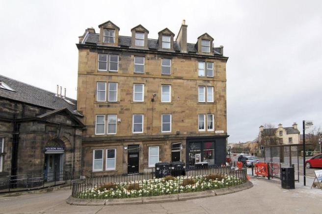
I lived in the heart of Edinburgh for 10 years and my happy home during these years was my flat in the Southside. I love that flat. It was the first place that was truly mine, and I had the privilege of sharing it with some of the best human beings I have ever known (I’m looking at you J & P). There are many many stories bound up in that place.
I love the quirky, strange and odd, and one of the things that appealled about my little flat was that it was in one of those weird Edinburgh streets – the kind that they put on the taxi-driver exam – the kind that no delivery driver can find. It was barely a street at all. One tenement block and a small community hall, with a strange tarmac area in front with a flower bed. 12 flats in the stair and 1 main door flat in total. It was a good mix of residents and people passing through too – enough that it felt like there was some community.
I’d wondered in the past about the etymology of the street name – Spittalfield Crescent – and whether it ever had been a larger street. I knew that the tenement block was built around 1880, and that Nelson Hall Community Centre next door was built in the early 20th century. I also know that Spitalfields in London is thought to derive it’s name from a nearby hospital, and so I wondered if the same might be true here (the Deaconess Hospital being just up the road).
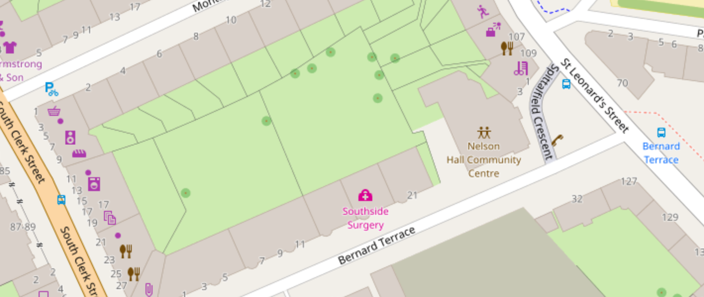
There has been some great work done in Edinburgh improving the quality and detail in Open Street Map, so here’s a snapshot of how things look today. Spittalfield Crescent is that little weird street on the right had side, joining St Leonard’s to Bernard Terrace.
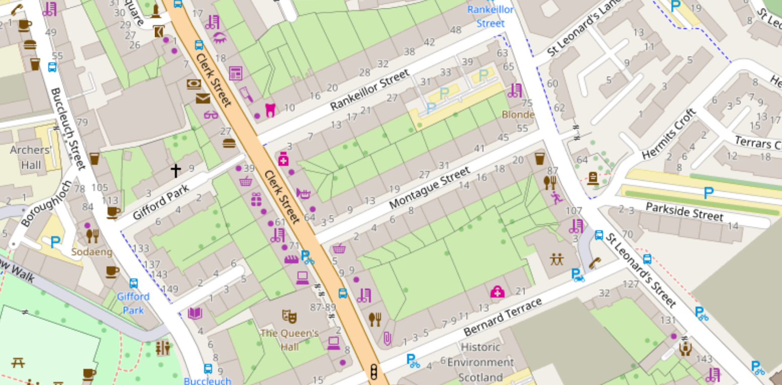
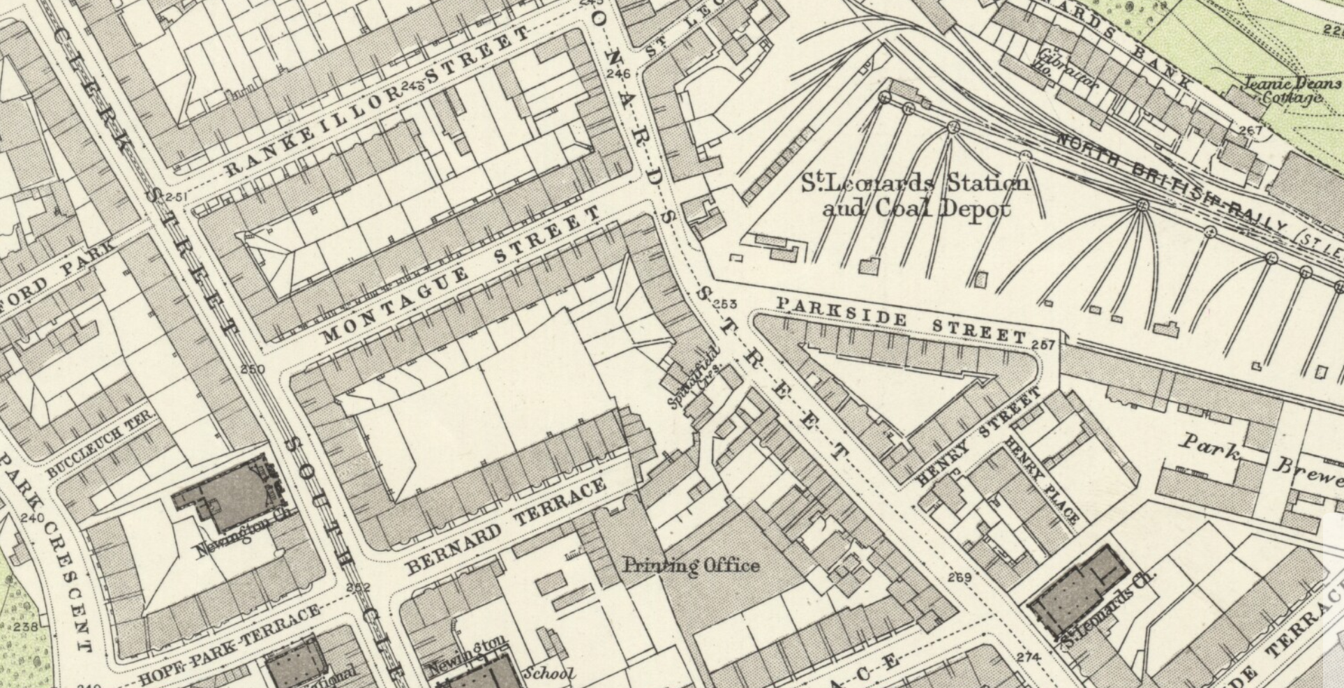
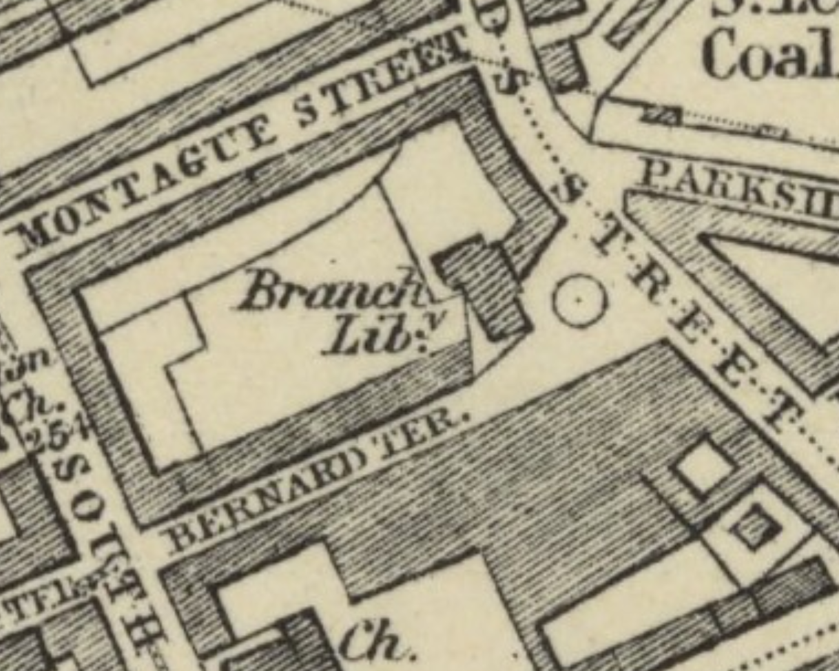
Stepping back a bit, here’s Bernard Terrace, Montague Street, and Rankeillor Street. All in a row. Take note of these streets – and Parkside Street – you’ll need them on the older maps.
The National Library of Scotland has done incredible work digisting their map collections and so I was able to cycle right back in time and see if I can work out how the street came to be, and where the name came from. The map below from 1817 shows that the road now called Dalkeith Road was called Spittle Field. I love the detail in this map, the fields and trees are simply beautiful. Mr Batchelor’s Pepperment Distillery sounds good too. At this stage this is pretty much the southern end of the city centre.
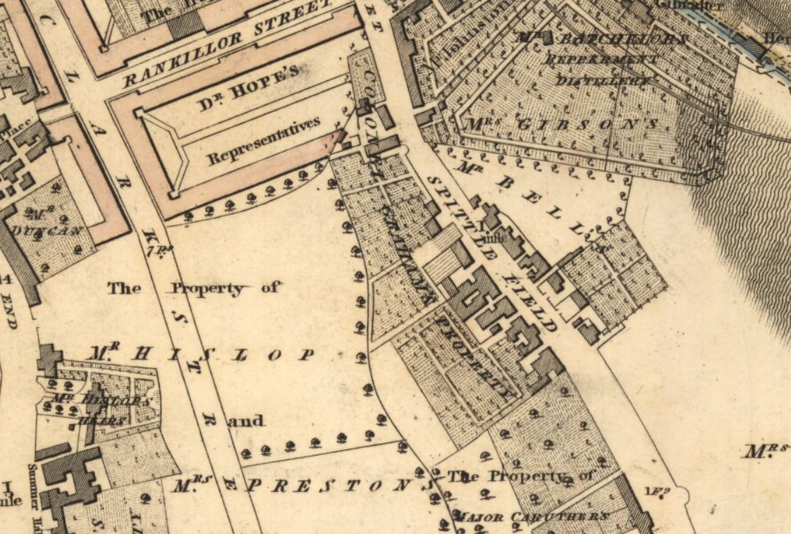
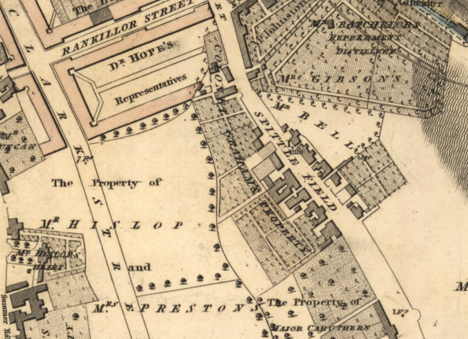
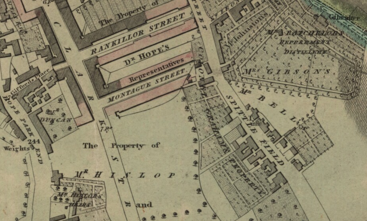
Skip forward to 1821 and we have Montague Street being built to the south of “Rankillor Street”. Mr Batchelor still cranking out the Pepperment.
Both of the Kirkwood maps provide quite rich information about land use and ownership. Jumping forward again to 1826 we switch over to the maps being made to support the postal service in Edinburgh. Montague Street has vanished (it’s still there – honest) and “Spittle Field” has contracted to “Spittlefield”. No Pepperment Distillery 🙁
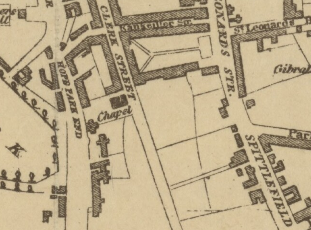
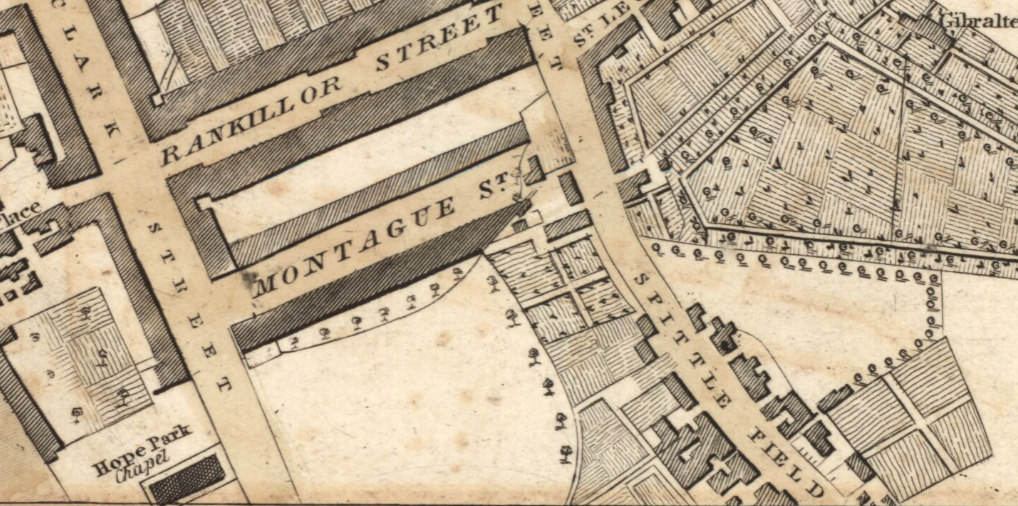
Back to the more beautiful map making (would you look at the hatching in those fields). and we have Montague Street back again (mostly – bit messy where it joins St Leonard’s / Spittle Field – this is important – we will see this again). Looking down Spittle Field, there’s a clutch of buildings scattered along the road.
By 1836 the road name “Spittle Fields” is gone, and the Innocent Railway has arrived at Parkside. Rankiellour Street is still having an ongoing spelling crisis.
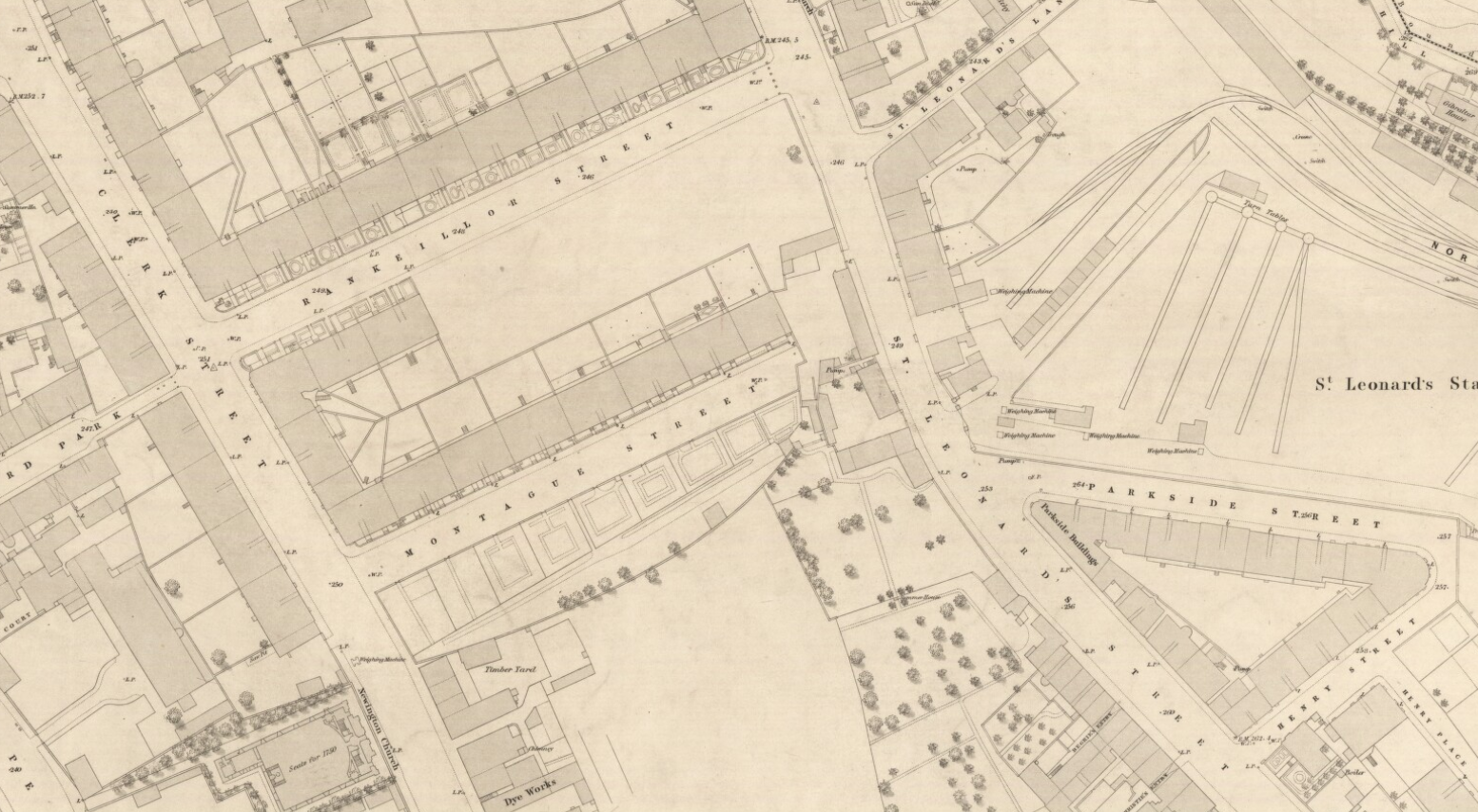
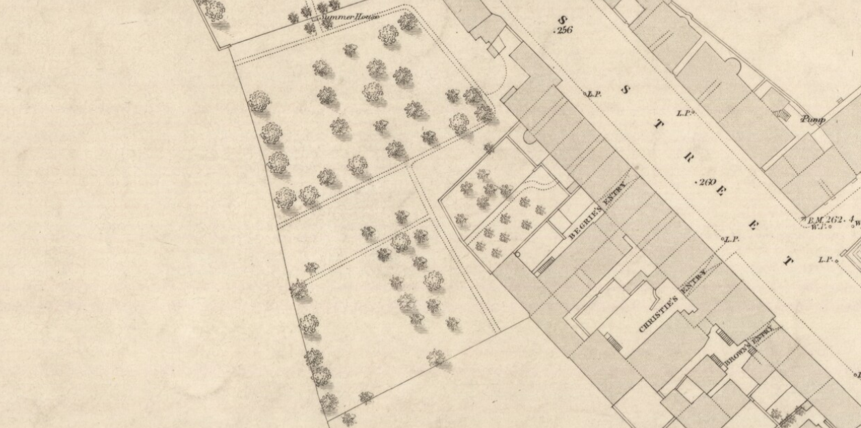
Things stay pretty much the same for a few years now (or the map-makers can’t be bothered – difficult to tell). Then the Ordnance Survey arrives in 1853. This map is so fine and detailed – it’s a bit difficult to read – I’ve provided another zoomed in view below – but you should see it for real to appreciate it for yourself (you can do this, because this is our National Library and they make these things available online for the nation – have I mentioned this already?).
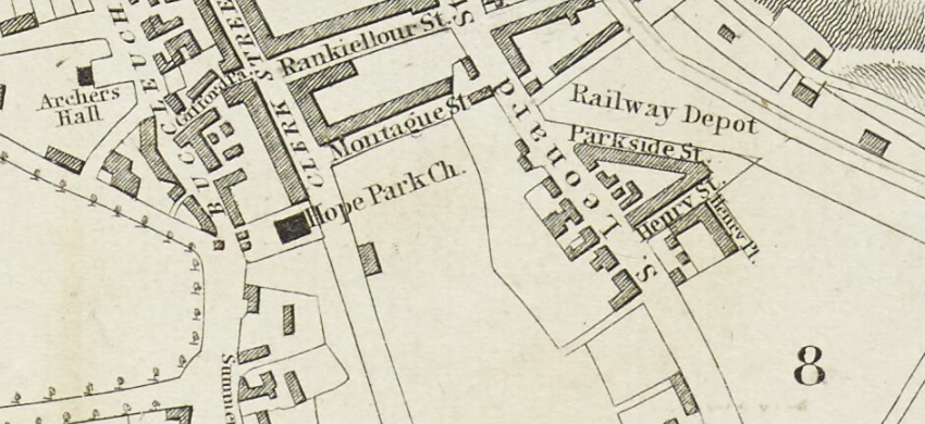
Jumping forward again to 1864 we have “Rankeilor Street” still not entirely sure how it’s spelled. The railway depot has expanded, and the Park Brewery has appeared, opened in 1860 by Thomas and James Usher. Their father was Andrew Usher, famous for whisky, Pear Tree House and the Usher Hall. Lutton Place, way to the south of Montague Street has been half built now too.
Hop, skip and jump forwards just a few years to 1867 and we have Bernard Terrace appearing. Like Montague Street it’s not fully formed – a sort of half street with a random collection of buildings at the end.
In 1877 we have another one of the absolutely beautiful and detailed Ordnance Survey maps, and this is where my home appears. 1877.
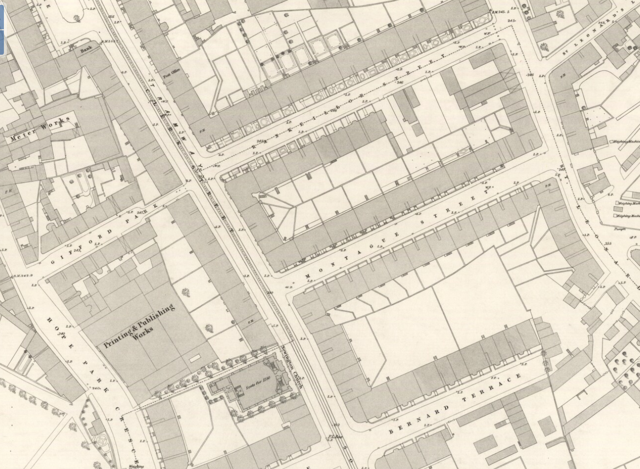
Just there on the end of the block, again not really fully formed. Barely a street at all. You can see the path from the back of the block out into the shared walled garden at the back of the block too. It’s still like that today.
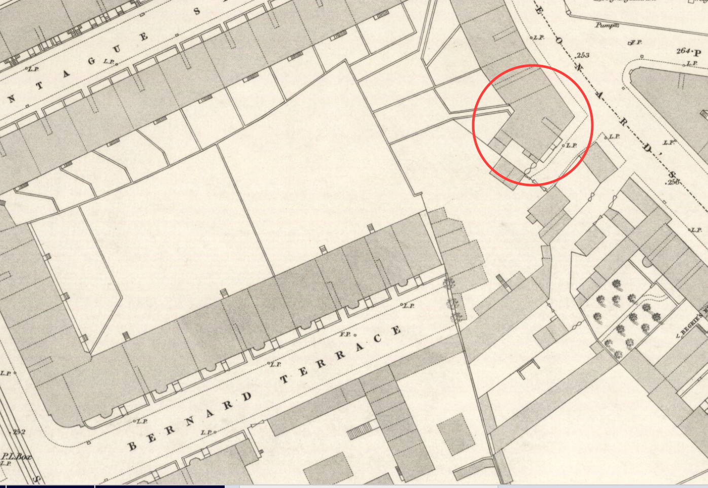
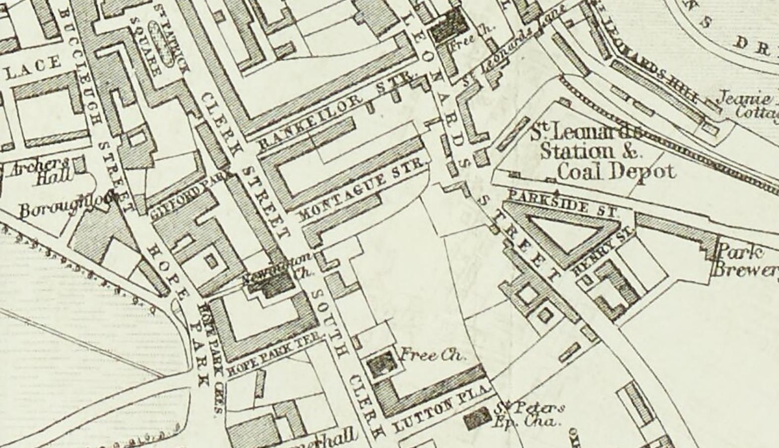
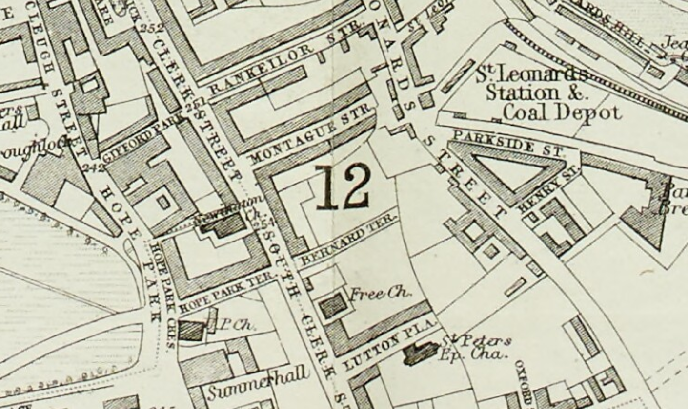
And now in 1893 the street has a marked name. 57 years after “Spittle Field” dropped off the maps the name has clung on to a single tenement block. Rankeillor Street also seems to have calmed down and settled into a form of letters which persists to this day.
The final acts in this story are the building of Nelson Hall in 1913 and finally in the mid 1930’s the joining up of St Leonard’s and Bernard Terrace.
Nelson Hall was shuttered and unused for all the time that I lived there. It was apparently part of the legacy of the Nelsons printing firm (Wikipedia article too). Look back at the Ordnance Survey map from 1877 and you can see a printing works at Hope Park. Shortly after in 1878 the works burned to the ground and the firm rebuilt at Parkside. Nelson Hall was built with the legacy of Thomas Nelson II as a place “to which persons of the working class and others can go to sit, read, write, converse and otherwise occupy themselves”. At the time John Buchan was a partner in the firm, and a year later in 1914 dedicated the Thirty Nine Steps to Thomas Nelson III.
And I thought I got to know the place pretty well when I lived there…
(Edinburgh : Kirkwood & Son, 1817. Reproduced with the permission of the National Library of Scotland CC-BY-NC-SA 4.0)
( © OpenStreetMap contributors CC-BY-SA)